Error message

Asia Pacific Issues Asia Pacific Issues
Does Unplanned Urbanization Pose a Disease Risk in Asia? The Case of Avian Influenza in Vietnam Does Unplanned Urbanization Pose a Disease Risk in Asia? The Case of Avian Influenza in Vietnam
Format
paper
Pages
8

Additional titles in the
AsiaPacific Issues series

SUMMARY  |  Cities are expanding very rapidly in Asia, often without adequate housing, transportation, water, or sanitation. These new "peri-urban" areas may be hot spots for disease, both in humans and domestic animals. Research into the possible link between unplanned urban expansion and disease outbreaks compared patterns of land-use change with two major outbreaks in Vietnam of highly pathogenic avian influenza (HPAI, subtype H5N1) that killed millions of chickens between 2003 and 2005. Work began by classifying communes into land-use categories: rural, peri-urban, urban, and urban core. The study found that peri-urban communes had at least a 150 percent higher risk of experiencing an H5N1 outbreak than did other types of commune, and that urbanization entails a spatial convergence of several key risk factors for H5N1 transmission. By focusing prevention programs on communes with these factors, the Vietnamese government can potentially improve disease prevention at lower cost. This research may also help explain the epidemiology of other infectious diseases, both in humans and livestock.

All over Asia, rural dwellers are moving to urban centers in search of better economic opportunities, and cities are growing at an unprecedented rate. In the 50 years between 1965 and 2015, Asia’s urban population increased nearly fivefold—from 430 million to 2.1 billion—and by 2015, nearly one-half of all people in Asia were living in cities.1

     This urban expansion has been largely unplanned. In city after city, local governments struggle to provide housing, sanitation, healthcare, transportation, and other infrastructure to areas with rapidly growing populations. These “peri-urban” areas, which often surround a core urban zone, represent a transition between rural and urban land-use types. Here new migrants live in crowded conditions with few public services and a poorly developed sense of community.

     The conditions that characterize these peri-urban areas have raised concerns about the potential rise of new and reemerging infectious diseases. These affect humans, economically important livestock, or both and include SARS, swine flu, and highly pathogenic avian influenza (HPAI, subtype H5N1). First detected in 1996 in geese in China, avian influenza has been described as the most significant newly emerging pandemic disease since HIV/AIDS.2

Highly Pathogenic Avian Influenza

Wild birds can carry the avian influenza virus without showing any signs of disease. Ducks and geese may also be infected without serious disease signs. But when domestic chickens become infected, the death rates can be catastrophic.

     Although they may not be strongly affected themselves, ducks are thought to play an important role in disease transmission in Southeast Asia. Following the region’s traditional integrated-farming practices, duck owners transport their birds to and from different rice paddies around a small region. The ducks provide a service to farmers because they eat insects that can damage rice plants and their manure helps fertilize rice paddies. As they travel from paddy to paddy, however, they are in contact with wild birds that carry avian influenza and also with domestic chickens that are highly susceptible to the virus.

     Once avian influenza appears in a flock of domestic chickens, the disease can spread rapidly, affecting multiple internal organs and killing 90 to 100 percent of affected birds, often within 48 hours. Outbreaks are generally controlled by killing entire flocks where infection has been detected and monitoring and vaccinating flocks nearby.

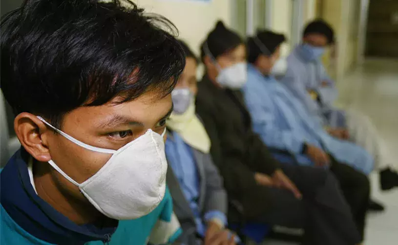
     Apart from the threat to poultry, avian influenza poses a risk to human populations. The virus was first detected in humans in 1997 during a poultry outbreak in Hong Kong, and since then it has killed more than 400 people in 16 countries.

     Up to now, most human infections have occurred following close or prolonged contact with infected poultry. There is concern, however, that the virus could mutate and become transmissible between humans, possibly causing a pandemic worldwide.

     To gain a better understanding of the potential link between land use and disease risk, beginning in 2010 the Center teamed with scientists at the Vietnam National University of Agriculture to study the role of unplanned urbanization in the emergence of infectious disease. The focus was on two of the worst outbreaks of avian influenza that occurred in Vietnam between late 2003 and early 2005, in which millions of poultry died from the virus or were culled in an effort to control the disease.

     The research goal was to improve understanding of how land-use change associated with urbanization and agricultural intensification might contribute to outbreaks of avian influenza in poultry. Such understanding could help policymakers identify specific areas at highest risk of a disease outbreak, making government prevention programs more effective and more efficient in terms of cost.

Why Chickens? Why Vietnam?

By providing a valuable opportunity for poor families to improve their own nutrition and to generate a cash income, chickens play an important role in economic development. In fact, philanthropist Melinda Gates writes that “chickens are known in international development circles as ‘the ATM of the poor’.” And in most developing countries, raising chickens is considered women’s work, so small-scale chicken producers tend to be women, and the nutrition and income provided by chickens goes straight to women and their children.

     Today, the dramatic growth of urban populations in developing countries is creating a huge demand for eggs and chicken meat. Much of this demand is being met by large farms in the peri-urban areas surrounding cities. In Vietnam and other countries of Southeast Asia, numerous intensive chicken farms have sprung up in these areas, typically raising 2,000–15,000 birds at a time.

     These intensive production units often co-exist side by side with traditional backyard chicken farming, not to mention other types of agriculture and aqua-culture mixed in with industrial, commercial, and residential use. Does this mixture of land-use types, economies, and social organizations raise the potential for disease transmission? And can research identify any factors associated with avian influenza outbreaks that could help government health departments fight the disease more effectively?

     Vietnam is a particularly appropriate setting for a study of avian influenza transmission and land-use change because: (1) the country is urbanizing very rapidly; (2) there is a large and growing poultry industry; and (3) detailed data are available on many factors associated with land-use change, poultry production, and disease outbreaks. The Vietnamese government carries out a Rural, Agricultural, and Fishery Census every five years that includes information on population, household production activities, labor and employment, income sources, categories of land use, and infrastructure, plus detailed economic data from large farms. The census covers all the households that report any farming activity in the entire country, including rural, peri-urban, and urban areas, and the data are made fully available to the public.

     This census information can be combined with land-use data derived from satellite imagery to build up a complete picture of land-use conditions all over the country, and this information can be compared with information on avian influenza outbreaks, which is available from Vietnam’s Department of Animal Health. Thus Vietnam provides an excellent opportunity to study the relationship between rapid urbanization and the emergence of infectious disease.

Vietnam’s Response to Avian Influenza

Avian influenza first appeared in Southeast Asia in 2003–2004 and remains endemic in Bangladesh, China, Egypt, India, Indonesia, and Vietnam. In Vietnam, there have been repeated disease waves and smaller outbreaks in poultry since the disease firstemerged. In addition, a total of 127 human cases had been reported, including 64 deaths, although no human cases have been reported in Vietnam since 2014.3

     Beginning in 2005, the Vietnamese government carried out mass vaccination campaigns every six months, designed to cover domestic chickens and ducks in areas that are considered at high risk of infection.4 Since 2010, the vaccination program has continued on a smaller scale, implemented primarily by provincial authorities.

     When a disease outbreak occurs, government workers cull all domestic poultry on the affected farms and vaccinate poultry in neighboring areas. This combined approach has been credited with reducing the occurrence of avian influenza, but government campaigns have not eliminated the disease entirely. It is also possible that reported disease incidence has gone down simply because farmers are hiding their sick birds.

     The full annual cost of the current program includes twice-yearly vaccination campaigns, emergency culling plus an extra round of vaccination in the surrounding area when there is a disease outbreak, compensation paid to farmers whose birds are culled, and the loss to farmers because the market price for poultry is higher than the compensation offered. Adding all these costs together, the annual cost of the program in the Red River Delta region in 2015 was estimated at US$9.7 million.5 This program is estimated to have reduced the rate of disease occurrence by about 62 percent.

Mapping the Urban Transition In Vietnam

Ecological theories6 and preliminary analysis of peri-urbanization and avian influenza risk7 suggested that there might be a link between rural-to-urban transition areas in Vietnam and outbreaks of avian influenza. But where are these areas? Before this study, the government classified all land units as either rural or urban—there was no category in between.

     To explore the possible relationship between land-use change and disease risk, research teams first needed to identify those areas that were experiencing a process of rural-to-urban transition. This first step was possible because the Vietnamese government provides data from its national censuses in a digital format at multiple scales, covering all 10,820 communes that comprise the country as a whole. (See box “A Changing Understanding of Land Use.”)

     The East-West Center analysis began with the 2006 Vietnam Rural, Agricultural, and Fishery Census, which surveyed all households that reported any type of farming activity. Among other topics, the census asked a wide range of questions on household characteristics, farming practices, and household infrastructure. After excluding communes in which no agricultural activities were reported and communes with missing or erroneous data, the analysis covered 92 percent of all the communes in Vietnam.

     Using census data, the research team classified each commune included in the analysis as rural, peri-urban, urban, or urban core. The study showed that communes classified as peri-urban have much in common, including a rapid pace of change. They generally face intense pressure on resources, lack of adequate services such as water and sanitation, degradation of farmland, the potential for slum formation, and a high likelihood of interaction between humans and domestic animals. They also face demands from users with contrasting lifestyles and conflicting interests that range from agriculture to residential, industrial, and commercial. And they are areas that are changing very quickly.

Identifying Factors Associated with Avian Influenza Risk

Since Vietnam experienced its first outbreak of avian influenza in December 2003, there have been five waves of the virus and several sporadic outbreaks. Collaborative research focused on the first wave that occurred between December 2003 and February 2004 and the second wave that occurred between December 2004 and April 2005. During the first wave, 21 percent of communes in Vietnam experienced a disease outbreak. During the second wave, 6 percent of communes experienced an outbreak.8

     Using the classification of the entire country into rural, peri-urban, urban, and urban-core communes, the research team sought to identify which types of community and patterns of land use are most strongly associated with outbreaks of avian influenza. The analysis was conducted at the national level and separately for two regions—the Red River Delta and the Mekong River Delta, both well-known hot spots for the disease.

     The study found that communes classified as peri-urban had about a one and one-half times higher risk of experiencing an avian influenza outbreak than rural or urban communes (there were no outbreaks in urban cores). This elevated level of risk was observed at the national and regional levels and during both disease waves. But within Vietnam’s 1,909 peri-urban communes, which specific attributes are associated with disease outbreaks?

     Vietnam’s 1999 Population Census and 2001 and 2006 Rural, Agricultural, and Fishery Censuses, among other sources, provide information for the development and testing of models of the emergence of avian influenza based on suspected risk factors and combinations of factors that are mainly associated with land-use change. The study developed two types of model9 to predict the probability of disease occurrence and to determine the relative influence of each risk factor. These models were chosen to account for the spatial clustering of cases. Again, the analysis covered the first and second disease waves and the three geographic areas (all Vietnam, the Red River Delta, and the Mekong Delta), adding up to six “wave-place” combinations.

     Fourteen variables were found to be significantly associated with avian influenza outbreaks in at least one wave-place combination. Of these, a smaller number were significantly associated with disease outbreaks in several of the six combinations. These were:

  • High land-use diversity
  • High population density of chickens
  • Diversity in the size of chicken, duck, and goose flocks, indicating the presence of small backyard production units alongside large commercial operations
  • Close distance to a national highway, indicating the potential for commercial movement of poultry
  • High proportion of agricultural land under rice or aquaculture, increasing the opportunity for virus transmission between wild birds and the domestic ducks that are transported between ponds and rice paddies
  • High Compound Topography Index (CTI), which measures the tendency of water to pool and serves as a proxy for the extent of surface water
  • Low annual rainfall

     All of these risk factors were widely observed in peri-urban areas. When all relevant risk factors were taken into account, urbanization per se was not significantly associated with a higher incidence of the virus, however. Indeed, the population density associated with urbanization is likely not a risk factor for disease if infrastructure such as housing, water, and health services are adequate. This is not the case in many of Vietnam’s peri-urban areas, however.10

     In reality, the process of urbanization entails a spatial convergence of several key risk factors for avian influenza transmission. These include: land-use diversity; high chicken population densities; diversity in flock sizes of chickens, ducks, and geese; a large fraction of land under rice or aquaculture; and a high CTI. It is these characteristics that make peri-urban areas likely “hot spots” for disease outbreaks.

Why Is this Work Important?

Highly pathogenic avian influenza (HPAI, subtype H5N1) presents a serious economic burden to large- and small-scale chicken producers in Vietnam and poses a potential threat to human populations. The research described here suggests that control of avian influenza could be improved by focusing prevention efforts on the locations that are most at risk of disease. And many of these locations are in peri-urban areas.

     At present, control of avian influenza is based primarily on two rounds of vaccination a year and covers all domestic chickens and ducks in large areas of the country. The production cycle for commercial chickens grown for meat is only eight weeks, however, so most commercial chickens are never vaccinated. A more targeted approach, using findings from this study on land-use classification and disease risk, would be to vaccinate poultry during every production cycle but in high-risk areas only, many of which are peri-urban.

     Looking at the Red River Delta, one of the hot spots for avian influenza in Vietnam, the rate of disease occurrence could be reduced by an estimated 93 percent, compared with a 62-percent reduction rate for the current vaccination program.7 And taking account of the full range of disease-control costs—which include the cost of the regular government vaccination program plus, in cases of disease occurrence, the costs of emergency vaccination rounds and culling, government compensation to farmers, and farmer’s losses due to market price differences—the cost of controlling avian influenza in the Red River Delta could potentially be reduced from US$9.70 million to US$6.92 million a year.

     More widely, a better description of the rural-to-urban transition, including the classification of peri-urban areas, may help explain the epidemiology of other infectious disease, both in humans and livestock. In Asia, for example, Japanese encephalitis and Korean hemorrhagic fever may show a strong association with peri-urbanization.

How Do the People Affected Perceive the Risk of Avian Influenza?

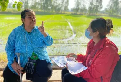
A study of community members in Vietnam who are potentially affected by avian influenza in poultry found that, overall, the participants were very concerned about disease outbreaks, particularly as a threat to household income and investment. Many saw modernization as a source of disease risk due to environmental pollution from poorly managed livestock and household waste. They reported, for example, that in crowded areas dead chickens are thrown onto the street or into fish ponds.

     Some reservations were expressed about the effectiveness of vaccinations against avian influenza. Participants complained that the vaccines were expensive and not necessarily of high quality and that it was difficult to select from the numerous brands of vaccine available on the market.

     Participants mentioned that there was no place to dispose of dead animals safely and that they were reluctant to report disease outbreaks because they did not want to trigger new culling campaigns. Some mentioned that information about avian influenza, including early warnings of possible disease outbreaks, could be communicated through newspapers and television.

     The East-West Center and collaborating institutions conducted the study. Small groups of village leaders, small-scale farmers, and large-farm operators were interviewed separately. They were asked several questions about their knowledge and experience of avian influenza and their understanding of disease risk. In the second phase of the study, the groups were also asked about their understanding of rural and urban land-use systems and the process of urbanization.

     The study11 was conducted in two phases—in May 2010 in four communes of Bac Ninh Province and in July 2011 in seven communes of Quang Ninh Province, all in north Vietnam. Seven of the 11 communes sampled were classified as peri-urban.

A Changing Understanding of Land Use

The collaborative research team classified Vietnam’s communes as rural, peri-urban, urban, or urban core based on four characteristics:

  • Fraction of households whose main income is from agriculture, forestry, or aquaculture
  • Fraction of land under agriculture, forestry, or aquaculture
  • Fraction of houses with a modern toilet (pour flush or septic)
  • A vegetation density index measured from satellite images

     After the initial classification, data from the Rural, Agricultural, and Fishery Census were supplemented with walk-through surveys, data on highways—a widely used marker of urbanization—from Vietnam’s General Statistics Office, and remote-sensing data from satellite images. These remote-sensing data measured changes in the intensity of night-time lights (another marker of urbanization) over an 18-year period from 1992 to 2009.

     In July and August 2012 and again in August 2013, researchers conducted walk-through surveys in 49 randomly selected communes and observed such features as land-use categories, types of agriculture, extent of industrialization, types of houses and other buildings, transportation infrastructure, and markets. They took 360° panoramic photographs at random spots, examined current and historic Google Earth images, and interviewed key local authorities and statistical officers. The classification of communes based on these observations matched the classification based on census data for 90 percent of the communes visited.

     Data on highway density also confirmed the initial classification of communes into four categories. And satellite imagery showed that communes classified as peri-urban had much larger increases in the intensity of night-time lights over an 18-year period than either rural or urban communes, indicating a rapid pace of land-use change.

     Out of Vietnam’s 10,820 communes, the study classified 1,909 as peri-urban. In the country as a whole, 71 percent of communes were rural, 18 percent were peri-urban, 3 percent were urban, and 4 percent urban core.12

     More than 7 percent of Vietnam’s land area was classified as peri-urban, and about 13 percent of its population—more than 11 million people—were found to live in peri-urban areas. Before this study, the Vietnamese government had classified 61 percent of the peri-urban communes as rural and 39 percent as urban.

     The study also showed that not all communes classified as peri-urban were located on the periphery of large towns or cities. Some extended along the sides of highways, and some were associated with zones of intense activity within rural areas, such as provincial administration centers, mining operations, or dams.

East-West Center Partners and Support for Avian Influenza Research

Collaborators in this study included Nghiem Tuyen of the Center for Natural Resources and Environmental Studies, Vietnam National University, Hanoi; Lam Nguyen, Tran Duc Vien, and Trinh Dinh Thau of the Center for Agricultural Research and Ecological Studies, Vietnam University of Agriculture, Hanoi; Michael Epprecht of the University of Bern, Switzerland; and Bruce Wilcox of Khon Kaen University, Thailand. The authors thankfully acknowledge former graduate students Charles Phan Nguyen, Duong Huu Nong, and Chinh Cong Tran for their assistance. This issue of AsiaPacific Issues was written by Sidney B. Westley, Communications Specialist at the East-West Center. This project was funded by the United States National Science Foundation Grant No. DEB-0909410.

Notes

1 United Nations (2014). World Urbanization Prospects, the 2014 Revision. https://esa.un.org/unpd/wup/. Accessed 17 October 2016.

2 Centers for Disease Control and Prevention (2015). Highly pathogenic Asian avian influenza A(H5N1) virus. http://www. cdc.gov/flu/avianflu/h5n1-virus.htm. Accessed 13 October 2016.

3 WHO (World Health Organization) (2016). Cumulative number of confirmed human cases for avian influenza A(H5N1) reported to WHO, 2003–2016. http://www.who.int/influenza/human_animal_interface/2016_10_03_tableH5N1.pdf?ua=1. Accessed 4 November 2016.

4 Phan Q. Minh, Roger S. Morris, Birgit Schauer, Mark Stevenson, Jackie Benschop, Hoang V. Nam, and Ron Jackson (2009). “Spatio-temporal epidemiology of highly pathogenic avian influenza outbreaks in the two deltas of Vietnam during 2003–2007.” Preventive Veterinary Medicine. 89:16–24.

5 Chinh C. Tran, John E. Yanagida, Sumeet Saksena, and Jefferson Fox (2016). “An alternative vaccination approach for the prevention of highly pathogenic avian influenza subtype H5N1 in the Red River Delta, Vietnam—a geospatial-based cost-effectiveness analysis.” Veterinary Sciences. 3, 6, doi:10.3390/vetsci3010006.

6 Bruce A. Wilcox and Rita R. Colwell (2005). “Emerging and re-emerging infectious diseases: Biocomplexity as an interdisciplinary paradigm.” EcoHealth. 2(4): 244–57; Durrell D. Kapan, Shannon N. Bennett, Brett Ellis, Jefferson Fox, Nancy D. Lewis, James H. Spencer, Sumeet Saksena, and Bruce A. Wilcox (2006). “Avian Influenza (H5N1) and the evolutionary and social ecology of infectious disease emergence.” EcoHealth. 3(3): 187–94.

7 James H. Spencer (2013). “The urban health transition hypothesis: Empirical evidence of an avian influenza Kuznets curve in Vietnam?” Journal of Urban Health. 90(2) :343–57.

8 Sumeet Saksena, Jefferson Fox, Michael Epprecht, Chinh Tran, Miguel Castrence, Duong Nong, James Spencer, Nguyen Lam, Melissa Finucane, Tran Duc Vien, and Bruce Wilcox (2014). Role of Urbanization, Land-Use Diversity, and Livestock Intensification in Zoonotic Emerging Infectious Diseases. East-West Center Working Papers, Environment, Population, and Health Series No. 6. Honolulu: East-West Center.

9 The models are a multi-level Generalized Linear Mixed Model (GLMM) and Boosted Regression Trees (BRT). See Sumeet Saksena, Jefferson Fox, Michael Epprecht, Chinh C. Tran, Duong H. Nong, James H. Spencer, Lam Nguyen, Melissa Finucane, Vien D. Tran, and Bruce A. Wilcox (2015). “Evidence for the convergence model: The emergence of highly pathogenic avian influenza (H5N1) in Vietnam.” PLoS ONE. 10(9): e0138138, doi 10.1371/journal.pone.0138138.

10 Sumeet Saksena, Jefferson Fox, Michael Epprecht, Chinh Tran, Miguel Castrence, Duong Nong, James Spencer, Nguyen Lam, Melissa Finucane, Tran Duc Vien, and Bruce Wilcox (2014b). Role of Urbanization, Land-Use Diversity, and Livestock Intensification In Zoonotic Emerging Infectious Diseases. East-West Center Working Papers, Environment, Population, and Health Series No. 6. Honolulu: East-West Center.

11 Melissa L. Finucane, Tuyen Nghiem, Sumeet Saksena, Lam Nguyen, Jefferson Fox, James H. Spencer, and Trinh Dinh Thau (2014). “An exploration of how perceptions of the risk of avian influenza in poultry relate to urbanization in Vietnam.” EcoHealth. 11:73–82.

12 Sumeet Saksena, Jefferson Fox, James H. Spencer, Miguel Castrence, M. DiGregorio, Michael Epprecht, N. Sultana, Melissa Finucane, Lam Nguyen, and T. D. Vien (2014). “Classifying and mapping the urban transition in Vietnam.” Applied Geography. 50:80–89.

About the Authors

Sumeet Saksena is senior fellow at the East-West Center.
He can be reached at: [email protected]

Nong Huu Duong is lecturer at the Department of Agro-ecology, Faculty of Environment, Vietnam National University of Agriculture.
He can be reached at: [email protected]

Melissa Finucane is senior behavioral and social scientist at the RAND Corporation, and senior fellow at the East-West Center.
She can be reached at: [email protected]

James H. Spencer is professor and associate dean of Research and Graduate Education at Clemson University, and adjunct senior fellow at the East-West Center.
He can be reached at: [email protected]

Chinh C. Tran is vice director at Center for Community Support Development Studies in Vietnam.
He can be reached at: [email protected]

Jefferson Fox is senior fellow at the East-West Center.
He can be reached at: [email protected]


The views expressed in this publication are those of the authors and not necessarily those of the Center.


Related Projects
Modernization and Emerging Infectious Diseases: The Case of Avian Influenza in Vietnam